Local, Sustainable, and Army Green: restoring native groundcover at Fort Gordon
by Bryan Mudder
In the summer of 2008, the Fort Gordon Natural Resources Division approached Joan Walker, research plant ecologist with the Forest Service Southern Research Station, with the challenge of figuring out how to establish native grasses and herbaceous plants on a typical southern forest stand just after harvest, to improve wildlife habitat while restoring ecosystem structure and function. As a research technician working with Walker, I soon find myself pondering a sun-scorched sand hill at the Fort Gordon United States Army Installation near Augusta, GA, envisioning its eventual conversion from barren clear cut to the browns, yellows and greens indicative of a longleaf pine-wiregrass savanna.
The Army slogan, “If you don’t conserve it, you don’t deserve it!”, conveys the intense personal commitment to national security and to environmental services expected of those serving on military bases.
Land managers at Fort Gordon, home to The Signal Corps and Signal Center, face a formidable stewardship challenge. How do you provide training sites for soldiers, while managing all of the natural resources over approximately 56,000 acres? This means ensuring clean air, water, and habitat for endangered species, improving soil, and providing recreation opportunities, including hunting and fishing all while ensuring an economic return from timber. Hot, humid, and harsh describe the nutrient deficient soils of the Fort, which sits on the Fall Line, a relatively thin geological boundary that runs from Columbus to Augusta, and separates the crystalline rocks of the Piedmont from the sedimentary rocks of the Atlantic Coastal Plain.
Bringing Back the Grasses
At the time of European settlement an estimated 90 million acres, extending from Virginia south to Florida and west into Texas, were dominated by longleaf pine forest. Currently, only about 3 million acres of the former longleaf pine forest exists in its historic range. Factors contributing to this decline include exploitation of longleaf pine for timber, the harvest of turpentine used for naval stores, conversion of forestland to agriculture, exclusion of fire, and the onset of urbanization. Longleaf pine forests are among the most species rich forest types in North America, supporting one of the most diverse understory plant communities in the world. There are approximately 122 endangered or threatened plant and animal species, including the red-cockaded woodpecker and the gopher tortoise, that call this ecosystem home. Restoring the natural diversity is one reason ecologists, natural resource managers, and private landowners are interested in restoring the longleaf pine ecosystem.

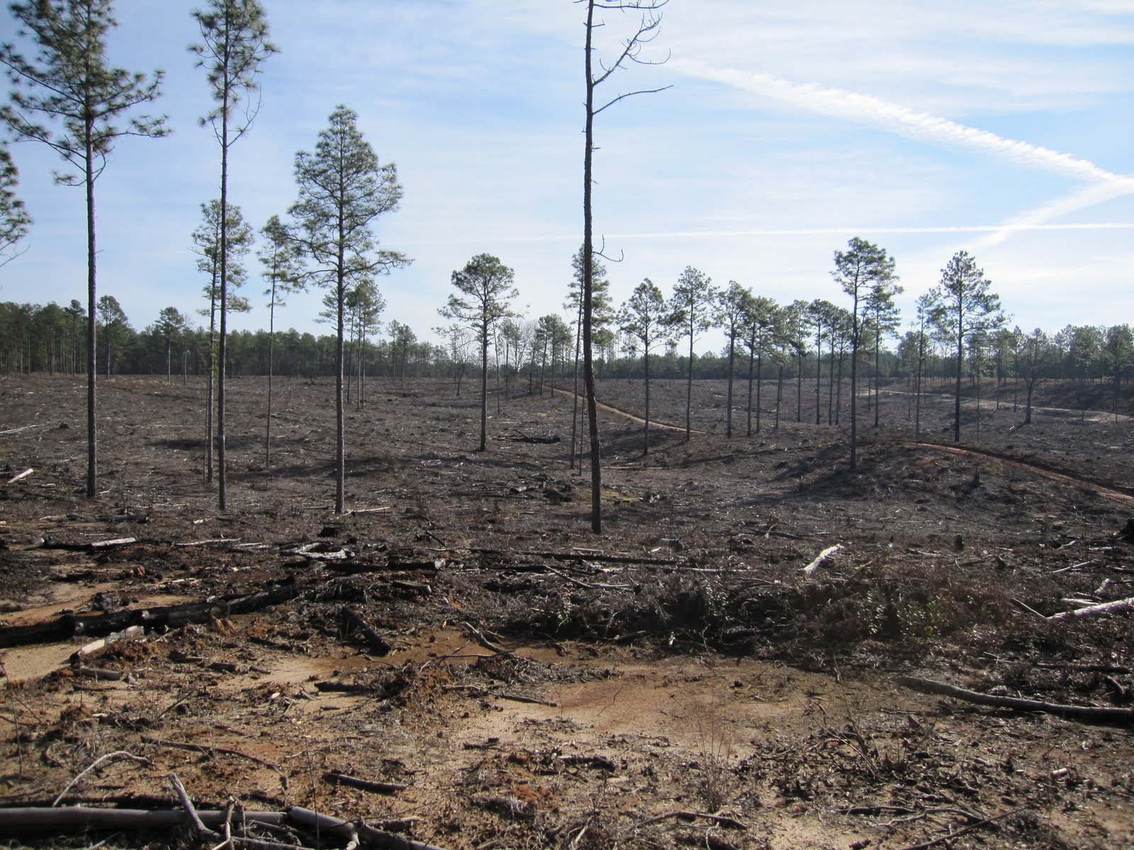
Back at Fort Gordon we set out to start restoration on a site we affectionately call TA 18. Training area (TA) 18 is approximately 46 acres of undulating sand hills that were clear cut between February and April of 2008. Clear cutting is a system where all (or most) of the mature forest canopy is removed to set the stage for artificially regenerating (that is, planting) a forest stand. In this case, Army land managers cut the loblolly pine trees that don’t belong on the sand hills to plant longleaf pine, a species better-suited to the soil and environmental conditions at TA 18.
By February 2009, our blank canvas was prepared.
The harvesters cut all the loblolly pine trees from the site, leaving only mature longleaf pine and some hardwood trees, the latter mostly oaks and cedars. The logging debris was piled for later burning, and we started with was a landscape devoid of any ground-layer vegetation or substantial forest over story.
We needed to answer two basic questions before we could restore grasses and other plants native to the site. What kind of forest sites would provide a seed mix best suited for TA 18? What site preparation did we need to get plants started from seed? We installed a pilot study during March 2009 to test two types of locates for seed collection -- one type had mostly wiregrass and the other had wiregrass mixed with bluesgtem grasses -- combined with four site preparation methods. To prepare the site for planting we used 4 treatments ranging in intentisy from no treatment at all to raking and digging.
Control - no site preparation
Clipping - remove all above-ground vegetation by clipping at soil level
Raking - remove surface litter, scarify soil layer leaving exposed bare mineral soil
Digging - remove aboveground and belowground vegetation tilling the soil much like a garden bed
Native seeds in general have relatively low rates of germination. We hypothesized that digging or raking would be best for establishing seedlings and that the mixed seed location would yield more successful germination. We installed the treatments, collected data, analyzed, and pondered. Our results showed that raking, followed by digging established the best conditions for seedling development and that the two seed collection types yielded similar numbers of seedlings. Initial questions answered.
By the end of this pilot study in November 2009 managers had burned the large piles of slash and applied an herbicide to inhibit growth of hardwood sprouts, notorious for derailing restoration plantings. The site remained mostly devoid of vegetation. Applying what we learned from our pilot study, we mimicked the raking treatment with a drum chopper,...
... then decided to use seed from any site that had desirable native species, desirable soil types, species deemed important for our restoration goals, and few aggressive weeds. Seed was most abundant on sites that had been burned recently...
...We collected seeds both by hand and with the aid of a seed flail-vac, best described as a giant motorized dust buster mounted to the front of a small tractor. Though frustrated by the paucity of suitable sites, we still collected about 20 pounds of seed. We sowed seed on approximately 3 acres of TA 18 in January 2010, then planted 12,500 wiregrass plugs (seedlings grown in containers under ideal conditions) on an additional 4 acres by the end of March 2010...
...Longleaf pine tree seedlings were planted across the entire site in April 2010. Though small, our initial success has already been realized with the emergence of a continuous layer wiregrass, bluestems, and various native herbs on TA 18!
Cirsium spp.
Liatris spp.
Slow and steady wins the race, right? Our short-term goal is to work out the kinks of native seed collection, storage, and sowing to establish desirable vegetation on TA 18. We hope to eventually restore our site to what forest ecologists call a “reference condition,” one that represents the species composition, structure, function and health of an ideal tree-dominated biological community – in this case longleaf pine - on that specific plot of land. Or as measured by that old Army slogan, “We do conserve it and we do deserve it!”
Based in Clemson, SC, Bryan Mudder is a biological science technician with the SRS Longleaf Pine Ecosystems unit.